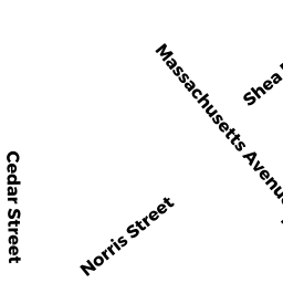
53R CEDAR ST
Owner Information
CLARK, STEVEN N. & NANCY G. PAGAN
53R CEDAR ST
CAMBRIDGE, MA 02140


Property Details
53R CEDAR ST is classified as a Two-Family Residential (Old style two fam).
The primary structure on this property was built in 1965. There are 2460ft2 of built area within this property. There is 2002ft2 of residential/living space within this property. This property is listed as having 6 rooms. There are 2 units within this property.
53R CEDAR ST is valued at 1205800. The land is valued at 607100 and the structures are valued at 598700.
This property is in Zone B. Confirm with local Zoning Board authorities to ensure there are no overlays or other easements on this property.
The most recent deed for 53R CEDAR ST is recorded at the local registrar in Book 44386, Page 0266. 53R CEDAR ST was last sold on 2004-12-29 for 800000.
Assessment data from fiscal year 2021.
Flood Data
According to the FEMA National Flood Hazard Layer, this property does not appear to be in a flood zone. It may also be in an area not yet reviewed. Nonetheless, confirm this information prior to taking any action.
To view the flood hazards around this property, create a FEMA "Firmette" Map of the area around 53R CEDAR ST.
Broadband Internet Providers
| Provider | Type | Bandwidth (mbps) | |
|---|---|---|---|
| HughesNet | Satellite | 25 | 3 |
| VSAT Systems, LLC. | Satellite | 2 | 1 |
| Viasat Inc | Satellite | 100 | 3 |
| Verizon New England Inc. | DSL | 7 | 0 |
| Comcast | Cable | 1000 | 35 |
| Starry, Inc. | Fixed Wireless | 200 | 200 |
| netBlazr Inc | Fixed Wireless | 50 | 50 |
| GCI Communication Corp. | Satellite | 0 | 0 |
Broadband service provider data from December 2020.
Adjacent Properties
- 45-47 REED ST
CONDO-BLDG owned by DOIRON, BELLA - 45-47 REED ST #1
Residential Condominium owned by DARRAH, JOHN & EMILY NEWMANN - 45-47 REED ST #2
Residential Condominium owned by NEWMANN, EMILY - 41 REED ST
CONDO-BLDG owned by 41 REED ST LLC - 41 REED ST #A
Residential Condominium owned by WADHWA REED LLC - 41 REED ST #B
Residential Condominium owned by BROWN, STUART B. - 35 REED ST
Single Family Residential owned by CAY, WILLIAM S. & AMY WOLFF CAY - 53 CEDAR ST
Single Family Residential owned by LEHRER, MATTHEW & - 55 CEDAR ST
Single Family Residential owned by PETROV, PAVEL V. & NANCY I. PETROV - 51 CEDAR ST
CONDO-BLDG owned by 51 CEDAR STREET LLC - 51 CEDAR ST #51A
Residential Condominium owned by POPTANI, ALICIA & MOHAMMED POPTANI - 51 CEDAR ST #51C
Residential Condominium owned by SMITH, PAULA - 51 CEDAR ST #51B
Residential Condominium owned by SUEN, KENNETH